Plateaus in Kemer
Sude Kırık
03 Mar 2024
- 7 min readWe are currently curating the best experiences for this destination. Check back later for exclusive tours. Salalah
We are currently curating the best experiences for this destination. Check back later for exclusive tours. Nizwa
Our travel editors are currently writing the ultimate guide for this destination. Stay tuned for expert tips and hidden gems. alexandria


Item added to your cart

Sude Kırık
03 Mar 2024
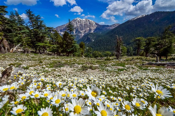
- 7 min readKemer is known for its nature and geography. Its plateaus attract both local and foreign tourists. The cool climate of the plateaus, especially during hot summer days, attracts tourists and locals. Kemer's plateaus provide relief for those feeling too hot in the summer.
Kemer has one side facing the sea and the other side surrounded by tall mountains. In the hot and dry summer months, Kemer stands out with its weather. Its plateaus in the high areas not only offer a visual feast but also enchant visitors with their climate.
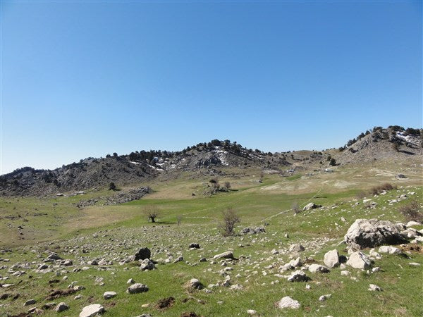
Beycik, Ovacik, Yayla Kuzdere, and Ucoluk, especially, the plateaus in Kemer, stand out for their amazing views and natural beauty. The plateaus where the locals in Kemer used to escape the summer heat have now become popular spots for both local and foreign tourists.
During your journey through the stunning plateaus of Kemer, you’ll naturally cool off, but you can also refresh yourself with Kemer’s wonderful water activities.
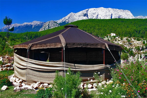
Located in Kuzdere Neighborhood, 18 km west of Kemer, Gedelme Plateau is an old settlement. The plateau sees an increase in population during summer, with local residents living there in winter too. At an altitude of 700 m, apples and walnuts are grown there. The plateau, part of the historic Lycian Way route including Beycik-Yaylakuzdere-Gedelme-Goynuk Plateau, is a popular stop for trekking groups. The region also attracts nature lovers throughout the year with its Kemer Beydaglari Walking and Cycling trails. There is a well-preserved Byzantine Medieval castle in the area, believed to date back to the 9th century AD. Known as the Kadrama / Gedelma Byzantine Castle, it means "grain drying pit." Another place to see in Gedelme is the Peynir Deligi cave next to the castle. The cave is 74 m long, with its deepest point noted at -19 m from the entrance. Next to the castle stands the 2500-year-old Giant Plane Tree, among Turkey's monumental trees. Besides accommodation facilities, there are also restaurant businesses on the plateau.
How to Get to Gedelme Plateau?
Gedelme Plateau is 60 km from Antalya city center and 18 km from Kemer. You can reach it by asphalt road from the Kesme Bogazi area in Kuzdere Neighborhood. In summer, you can visit Gedelme Plateau by minibus or private car.
Activities at Gedelme Plateau:
Gedelme Plateau Activity Routes:
Various Experiences To Enjoy Differnet Adventurous in Kemer
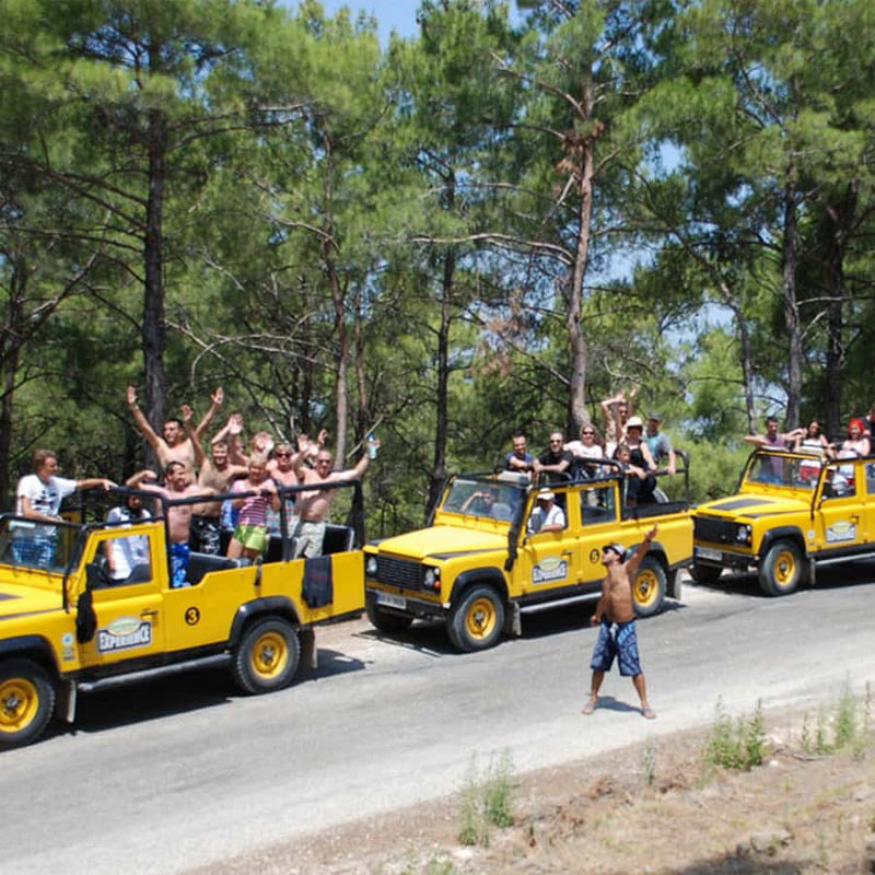
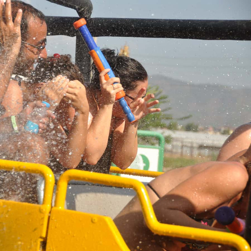
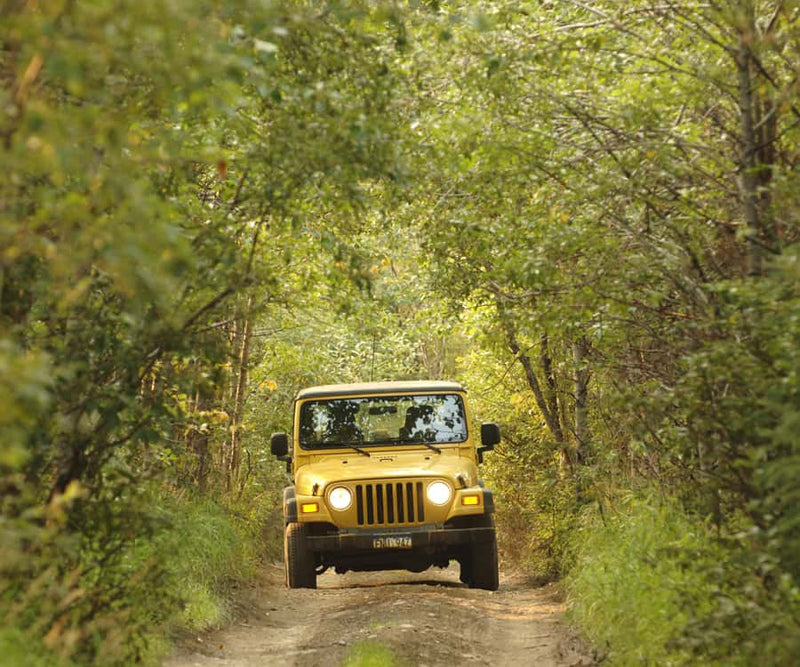
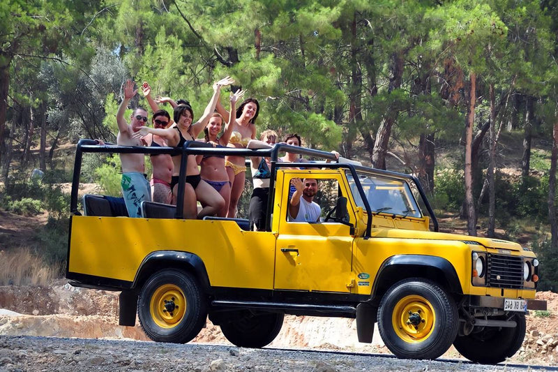
Kemer Jeep Safari with Off-Road
Off
Sold out
Regular price
$32.00 USD
Regular price
Unit price
/
per
Sale price
$32.00 USD
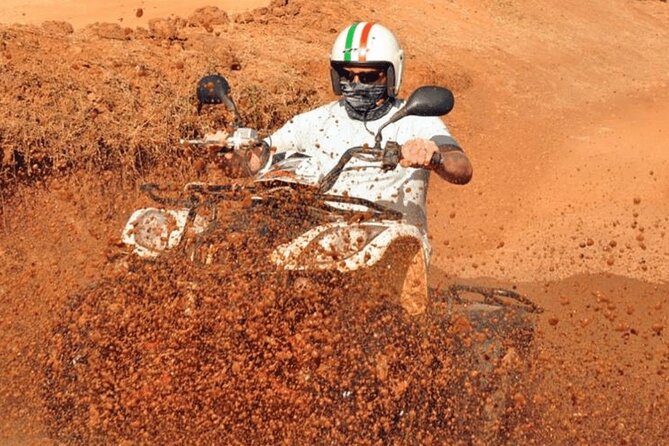
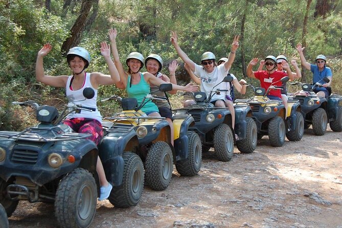
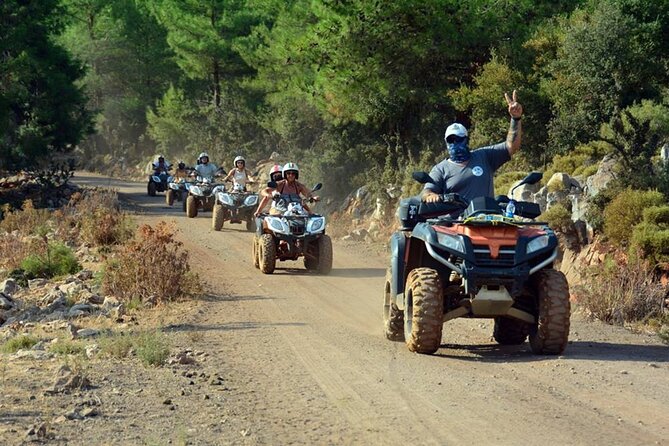
Kemer Adventures ATV Quad Safari Tour
Off
Sold out
Regular price
$35.00 USD
Regular price
Unit price
/
per
Sale price
$35.00 USD
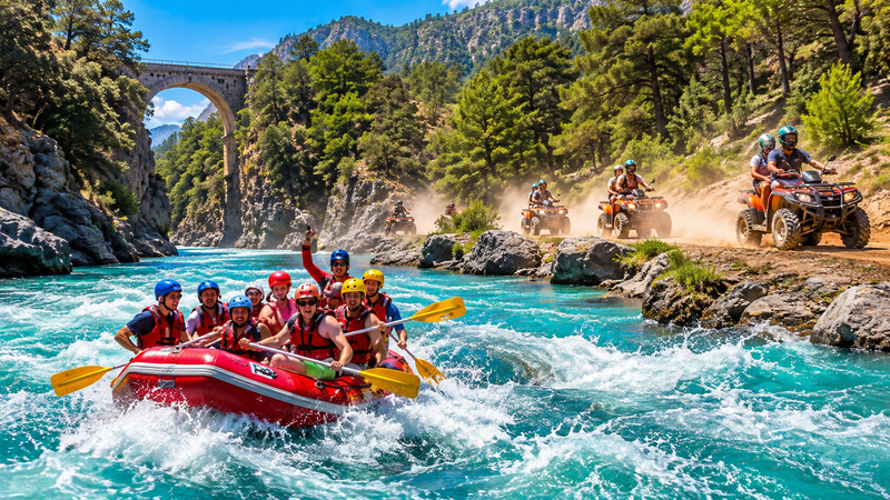
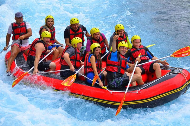
Kemer River Rafting & Jeep Safari Combo Tour
Off
Sold out
Regular price
$28.00 USD
Regular price
Unit price
/
per
Sale price
$28.00 USD
About 37 km away from Kemer, at an altitude of 1500 meters, the Ucoluk Plateau lies within the borders of Ulupinar neighborhood. It's a great place for camping enthusiasts with its natural beauty, including cedar trees. To reach the Ucoluk Plateau from Kemer, you take a road of about 37 km surrounded by cedar trees as pine trees disappear. The plateau, situated at around 1500 meters, is rich in plant and animal life. The simple plateau houses, without services like electricity and phone lines, blend in with the cedar and juniper trees, offering stunning natural beauty. The area provides walking and cycling trails in the Kemer Beydaglari Mountains, allowing for hiking and biking tours outside of winter.
How to Get to Ucoluk Plateau?
You can reach Ucoluk Plateau from Kemer by a 37 km gravel road passing through Beycik Plateau. Travel agencies organize camping and trekking programs from Kemer and Cirali regions.
Activities at Ucoluk Plateau:
Activity Routes at Ucoluk Plateau:
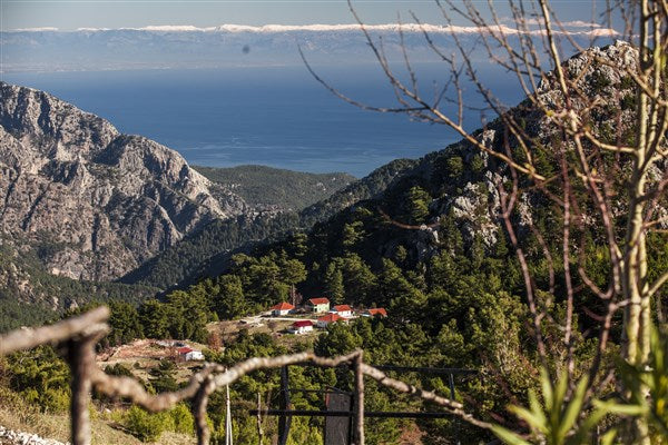
Beycik is a quiet, peaceful mountain village in Kemer district of Antalya province. It's in the Bey Mountains Coastal National Park, set on the slopes overlooking the sea of Tahtali Mountain. The stunning mountain views from any part of the village invite you to pause and take a deep breath. You can also see the Tekirova Three Islands view. The view is so breathtaking that you want to take it all in with one breath. One of the best features of Beycik Plateau, located at an altitude of 850 meters above sea level, is its air quality. The low humidity, distance from city noise, and natural food sources help the villagers lead a healthier life.
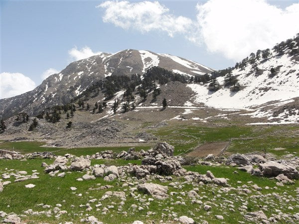
Beycik Plateau is situated on the historical Lycian Way route of Cirali-Beycik-Tahtalı Mountain-Yaylakuzdere and is one of the key stops for trekking groups. Additionally, there are Kemer Beydaglari Hiking Trails in the region, offering various options for nature lovers who want to spend time in nature. From Beycik Plateau with the most beautiful view of Tahtali Mountain, you can embark on an adventurous journey to the 2365 m summit via mountain climbing routes. In addition to accommodation facilities in the plateau, there are also restaurant businesses available.
How to Get to Beycik Plateau?
Beycik Plateau is 70 km away from Antalya and 25 km from Kemer. You can reach it by a paved road. In both summer and winter, you can easily visit Beycik Plateau using minibuses and travel agencies.
Activities at Beycik Plateau;
Beycik Plateau Activity Routes;
Kuzdere Plateau is a quiet settlement area in Kuzdere neighborhood, Kemer district, with stunning mountain views from the northern slopes of Tahtalı Mountain. It's mostly chosen by villagers in the summer, but a few families stay there in winter too. It's one of the accommodation spots for hiking groups on the historical Lycian Way route between Beycik, Kuzdere Plateau, and Gedelme. There are guesthouses offering village house stays in the plateau. Local people grow walnuts at this 950m high plateau. Kuzdere Plateau, where you can overlook the Beydaglarıi coast from above, is one of the plateaus where you can be close to nature with a mountain view among greenery.
How to Get to Plateau Kuzdere?
Plateau Kuzdere is 70 km away from Antalya and 28 km from Kemer. You can reach it by an asphalt road. During summer, you can visit Plateau Kuzdere with your own vehicle.
Activities at Plateau Kuzdere:
Plateau Kuzdere Activity Routes:
Located 24 km west of Kemer, Ovacık Plateau is a wide area for living on a plateau. Situated between the coastal Beydaglari and central Beydaglari, this plateau, with its green vegetation, is an ideal place to live on a plateau at an altitude of 1100 m. In recent years, Teke Mountain, a favorite spot for mountain climbers at an altitude of 2150 m, is also found within the borders of Ovacık Plateau. From Ovacık Plateau, you can enjoy the breathtaking Mediterranean view over the coastal Beydaglari. There is also a mountain hotel where you can stay close to nature in the area.
Local people in the region grow walnuts and cultivate wheat in the small and large plains of Ovacık.
Ovacık Plateau has been a transition point between the Beydaglari from past to present. The historical Lycian Way routes of Beycik-Goynuk Canyon and Phaselis-Goynuk Canyon pass through Ovacık Plateau. Additionally, the walking and cycling trails of Kemer Beydaglari and jeep safari tours in the region attract both local and foreign nature lovers who use the routes in Ovacık Plateau throughout the year.
How to Get to Ovacık Plateau?
Ovacık Plateau is 50 km from Antalya city center via Hisarcandir and 68 km from Kemer. From Kemer, you can reach Ovacık Plateau through an asphalt road at Kuzdere Neighborhood Kesme Bogazi location. During summer, you can visit Ovacık Plateau by minibuses or private cars.
Activities at Ovacık Plateau;
Activity Routes at Ovacık Plateau;
Ovacık - Goynuk Canyon 6 hours - 23 Km (Hiking)
Ovacık - Teke Mountain 4 km - 5 hours (Mountain Climbing)
Kemer - Ovacık - Sapandere 38 km (Mountain Biking)
Kemer - Ovacık - Kuzdere Plateau - Kemer 51 km (Mountain Biking)
Basically, the plateaus in the Kemer area, like Ovacık Plateau, are great for enjoying nature. You can see beautiful views, learn about history on the Lycian Way, and do fun things if you like adventures or nature. You can hike in rough areas, bike on tough paths, or just relax in the lovely landscapes. These plateaus near Kemer have something for everyone and are a must-visit place in Turkey for nature lovers.
We need these to confirm your booking.


