


I dette indlæg
Forestil dig at stå på mødestedet mellem to kontinenter, hvor gamle civilisationer engang levede, og moderne kulturer let blander sig. Dette er Tyrkiet — et land, der forbinder Europa og Asien og giver rejsende en fantastisk rejse gennem tid og geografi.
Når du ser, hvor Tyrkiet ligger på kortet, opdager du et land, der fungerer som en kulturel og geografisk gateway mellem øst og vest, hvilket gør det til et af de mest strategisk vigtige og mangfoldige rejsemål på jorden.
Kortet over Tyrkiet viser et land med en enestående variation: snedækkede bjerge i øst, klare blå middelhavskyster i syd, eventyrlige landskaber i midten og travle byer, der strækker sig over to kontinenter.

Denne kortguide viser et landområde på cirka 783,562 kvadratkilometer, der strækker sig fra Balkan til Kaukasus, fra Sortehavet til Middelhavet.
På verdenskortet indtager Tyrkiet en unik position, grænsende op til otte lande og omgivet af fire have.
På et kort over Tyrkiet vil du bemærke, at det grænser op til Grækenland og Bulgarien mod nordvest, Georgien mod nordøst, Armenien, Aserbajdsjan og Iran mod øst samt Irak og Syrien mod sydøst.
Denne strategiske placering har gjort Tyrkiet til en smeltedigel for kulturer, religioner og civilisationer i tusinder af år.
Formålet med denne komplette guide er at hjælpe dig med at navigere i dette storslåede land ved hjælp af detaljerede kort og insider‑viden.
Uanset om du planlægger dit første eller femte besøg, er det vigtigt at forstå Tyrkiets geografi for at skabe den perfekte rejseplan.
Vi udforsker alt fra velkendte destinationer som Istanbul og Cappadocia til skjulte perler i det østlige Anatolien og giver dig den geografiske kontekst og praktiske information, du behøver for at få mest muligt ud af dit tyrkiske eventyr.
Et nærmere kig på kortet over Tyrkiet
Placering på verdenskortet
Tyrkiets placering på kortet er intet mindre end ekstraordinær. Landet ligger på to kontinenter: cirka 97% af Tyrkiets landareal ligger i Asien (Anatolien), mens de resterende 3% ligger i Europa (Thrace). Denne tværkontinentale karakter er mest tydelig i Istanbul, hvor Bosphorusstrædet bogstaveligt talt adskiller Europa fra Asien.
Når du ser på kortet over Tyrkiet og de omkringliggende lande, kan du se, hvordan nationen fungerer som en landbro mellem kontinenterne. På verdenskortet ligger Tyrkiet i den antikke verdens hjerte, hvor Silkevejen engang knyttede handel mellem Øst og Vest. Denne geografiske fordel har ikke mindsket sig gennem århundreder.
Tyrkiet forbliver en central aktør i global politik, økonomi og kultur. Landets koordinater ligger cirka mellem 36° og 42° nordlig bredde og 26° og 45° østlig længde. Når du kigger på kortet over Tyrkiet og de omkringliggende lande, vil du bemærke, at Tyrkiets naboer omfatter nogle af verdens mest historisk betydningsfulde regioner.
Mod vest udgør Grækenland porten til Europa og Middelhavsarven. Mod syd forbinder Syrien og Irak Tyrkiet med Mellemøsten og de gamle mesopotamiske civilisationer. De østlige grænser til Armenien, Iran og Aserbajdsjan knytter Tyrkiet til Kaukasus og Centralasien, mens Georgien mod nordøst giver adgang til Sortehavsregionen.
Vigtige regioner på kortet over Tyrkiet
Istanbul og Marmararegionen

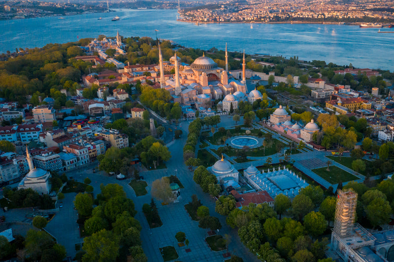
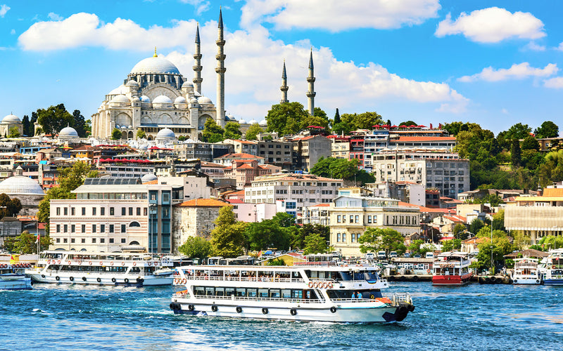
Når du ser på kortet over Istanbul, vil du straks forstå, hvorfor byen kaldes "byernes dronning." Kortet over Istanbul viser en by, der er delt af Bosporusstrædet, med den ene fod i Europa og den anden i Asien.
Dette geografiske vidunder gør Istanbul til den eneste by i verden, der ligger på to kontinenter. Kortet over Tyrkiets byer fremhæver altid Istanbul som landets mest folkerige by, hjem for over 15 millioner mennesker.
Den europæiske side rummer det historiske Sultanahmet-kvarter, hvor du finder Den Blå Moské (Sultan Ahmed-moskeen), Hagia Sophia, Topkapı-paladset og Den Store Basar. Bosporusstrædet, synligt på ethvert kort over Tyrkiets byer, fungerer både som geografisk skillelinje og kulturel bro, med færger, der konstant sejler mellem kontinenterne.
Udforsk Istanbuls historiske bydele

Istanbul: Hagia Sophia, Topkapi Palace, Den Blå Moské, Grand Bazaar & Hippodrom - Guidet tur
Udsalg
Udsolgt
Normalpris
$250.00 USD
Normalpris
Stykpris
pr.
Udsalgspris
$250.00 USD


Istanbul Galata & genovesisk eftermiddags gåtur med guide
Udsalg
Udsolgt
Normalpris
$65.00 USD
Normalpris
Stykpris
pr.
Udsalgspris
$65.00 USD


Guidet tur til Basilica Cistern i Istanbul med køfri adgang
Udsalg
Udsolgt
Normalpris
$44.00 USD
Normalpris
Stykpris
pr.
Udsalgspris
$44.00 USD

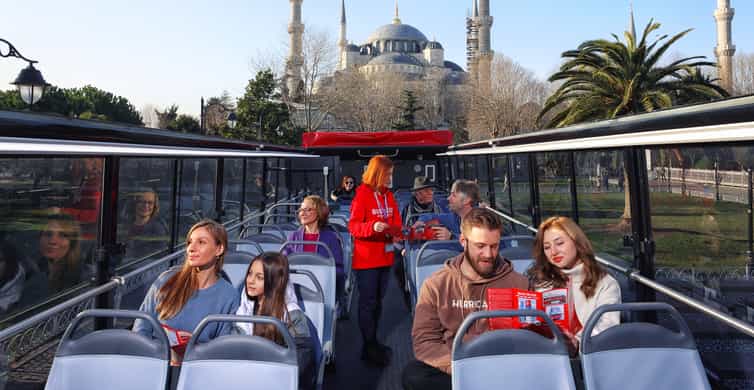

Heldagsbillet til Istanbul Hop-On-Hop-Off busrundtur
Udsalg
Udsolgt
Normalpris
$67.00 USD
Normalpris
Stykpris
pr.
Udsalgspris
$67.00 USD

Eftermiddagskrydstogt på Bosporus med svævebane til Pierre Loti-bakken
Udsalg
Udsolgt
Normalpris
$76.50 USD
Normalpris
Stykpris
pr.
Udsalgspris
$76.50 USD
Kortet over Istanbul viser byens strategiske position, der kontrollerer adgangen mellem Sortehavet og Middelhavet, hvilket har gjort den til en af historiens mest eftertragtede byer. Byzantinske kejsere, osmanniske sultaner og moderne præsidenter har alle anerkendt Istanbuls uovertrufne betydning.
Uden for bygrænsen omfatter Marmararegionen Bursa, den tidligere osmanniske hovedstad kendt for sine termiske bade og skioplevelser på Mount Uludağ, samt Edirne, berømt for den imponerende Selimiye-moské.
Kappadokien og Centrale Anatolien

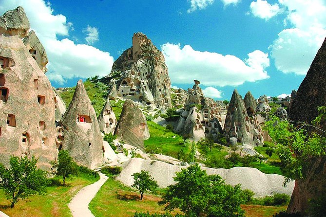
Kortet over Tyrkiets byer i Centrale Anatolien viser et af verdens mest unikke landskaber. Kappadokien, som fremgår af ethvert detaljeret kort over Tyrkiet, er ikke en enkelt by, men en region med flere byer som Göreme, Ürgüp, Avanos og Uçhisar.
Når du ser på kortet over Tyrkiets byer, vil du finde disse bebyggelser samlet i provinserne Nevşehir og Kayseri, cirka 730 kilometer sydøst for Istanbul. Geografien her fortæller en vulkansk historie formet gennem millioner af år.
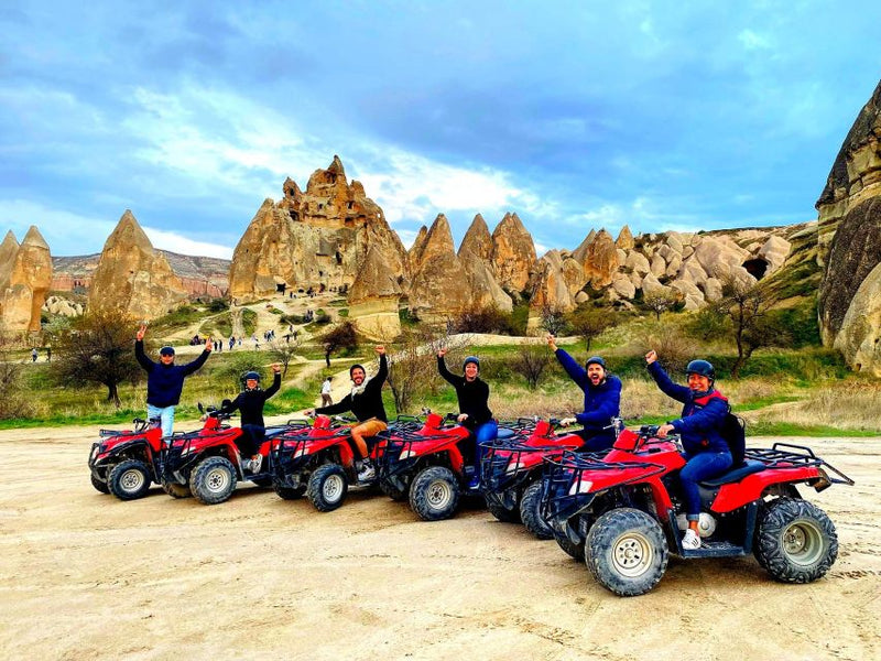
Oldtidens udbrud fra Mount Erciyes og Mount Hasan skabte de karakteristiske "fairy chimneys", kegleformede klippeformationer, der er blevet udskåret af vind og vand gennem tusinder af år. Når du ser på kortet over Istanbul og bevæger blikket østpå mod Kappadokien, vil du lægge mærke til den markante højdeforskel.
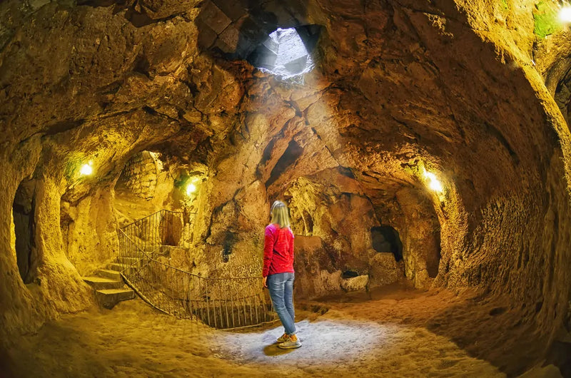
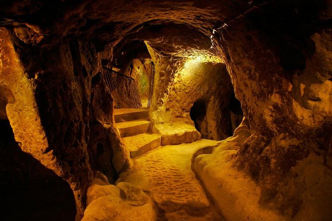
Kappadokien ligger i cirka 1,000 meter højde på den anatolske højslette. Regionens underjordiske byer, synlige på arkæologiske kort over Tyrkiets byer, strækker sig flere niveauer ned i den bløde vulkanske klippe.
De underjordiske byer Derinkuyu og Kaymaklı kunne rumme tusinder af mennesker og deres husdyr under invasioner. Over jorden byder Göreme Frilandsmuseum på klippehuggede kirker med byzantinske fresker fra det 10. århundrede.
Ægæerkysten

Ægæerregionen på kortet over Tyrkiet strækker sig langs vestkysten og rummer nogle af Tyrkiets mest besøgte oldtidssteder og moderne feriebyer. İzmir, Tyrkiets tredjestørste by, fungerer som regionens centrum og fremgår tydeligt på ethvert kort over Tyrkiet. Denne moderne by kombinerer nutidigt storbyliv med nem adgang til nærliggende antikke seværdigheder.
Lige syd for İzmir ligger den antikke by Ephesus, som er en af de bedst bevarede romerske byer i verden. Kortet over Tyrkiet viser Selçuk som den moderne by tættest på Ephesus, hvor du kan udforske Celsus-biblioteket, Det Store Teater med plads til 25,000 tilskuere og området med Artemistemplet, et af de syv vidundere i den antikke verden.
Længere syd langs kysten byder Bodrum (det antikke Halicarnassus) på en perfekt blanding af historie og natteliv. Kortet over Tyrkiets byer fremhæver også Çeşme og Alaçatı, berømte for windsurfing og charmerende stenhuse, samt Bergama (det antikke Pergamon), hjemsted for det spektakulære Akropolis og helbredelsestemplet Asclepion.
Middelhavskysten

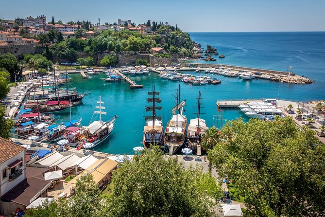
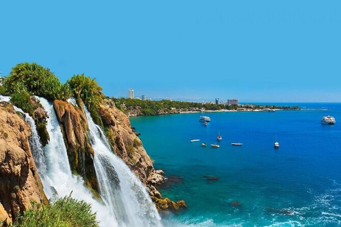
Når du ser på kortet over Tyrkiet langs Middelhavet, skiller Antalya sig ud som regionens kronjuvel. Dette kystparadis, tydeligt markeret på kortet over Tyrkiet, byder hvert år millioner af besøgende velkommen til sine uberørte strande, oldtidsruiner og moderne resorts. Kortet over Tyrkiet viser, at Antalya-provinsen strækker sig langs den turkisblå kyst, kaldet "Den Tyrkiske Riviera."
Den antikke Lycian Way, en af verdens førende langdistancevandrestier, forbinder mange kystbyer, som kan ses på kortet over Tyrkiets byer, når du zoomer ud for at se hele landet. Byer som Kaş, Kalkan, Fethiye og Olimpos byder på dramatisk bjerg-til-hav-landskab.
Sammenligning af kortet over Istanbul og Tyrkiet viser, at disse sydlige byer nyder et middelhavsklima med over 300 dage med solskin om året, i kontrast til Istanbuls mildere vejr.
Side og Alanya, fremhævet på kortet over Tyrkiet, rummer imponerende oldtidsruiner integreret i moderne resort-infrastruktur. Regionen omfatter også Pamukkales travertinterrasser inde i landet, selvom de geografisk hører til Ægæerens overgangsområde.
Østlige Anatolien og Mount Ararat

Kortet over Tyrkiet i det østlige Anatolien afslører Tyrkiets mest afsides og spektakulære vildmark. Denne region, mindre besøgt men særdeles belønnende, viser på kortet bycentre som Erzurum, Van, Kars og Ağrı. Kortet over Tyrkiet viser, hvor tyndt befolket dette bjergområde er sammenlignet med det vestlige Tyrkiet.
Mount Ararat (Ağrı Dağı), Tyrkiets højeste top på 5,137 meter, dominerer landskabet nær de iranske og armenske grænser. Denne slumrende vulkan, som mange mener er Noahs Arkens hvilested, kræver særlige klatretilladelser.
Søen Van, Tyrkiets største sø — kort over Tyrkiets byer viser byen Van på dens østlige bred — byder på storslået alpint landskab og det unikke İshak Pasha-palads nær Doğubayazıt.
Den gamle armenske hovedstad Ani, nær Kars, står som en uhyggelig påmindelse om regionens komplekse historie. Kortet over Istanbul, sammenlignet med disse østlige byer, viser de enorme afstande. Der er over 1,600 kilometer fra Istanbul til Mount Ararat, omtrent samme afstand som at køre fra London til Rom.
Bykort over Tyrkiet: Hvor du skal tage hen i de største byer
Istanbul: Den kulturelle hovedstad

Kortet over Tyrkiets byer starter uundgåeligt med Istanbul, men for at forstå denne megaby kræves flere kortlag. Kortet over Istanbul viser et komplekst bybillede opdelt i 39 distrikter fordelt på to kontinenter.
Kortet over Istanbul viser, hvordan Bosporusstrædet, Det Gyldne Horn og Marmarahavet skaber naturlige skel, der har formet byens udvikling gennem tusinder af år. Kortet over den europæiske side viser Sultanahmet (den historiske halvø) som turistcentrum.
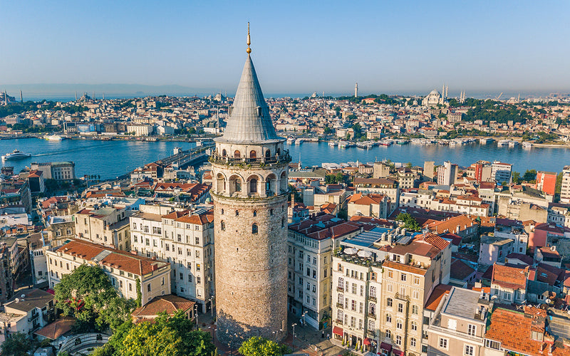
Her, inden for gåafstand, finder du Hagia Sophia, Den Blå Moské, Topkapı-paladset, Basilica Cistern og Hippodromen. Bevæg dig nordpå langs Det Gyldne Horn, og du når Beyoğlu-distriktet, som rummer Istiklal-gaden, Galata-tårnet og det livlige Karaköy-kvarter.
Den asiatiske side, synlig på kortet over Istanbul, byder på en mere boligpræget og autentisk tyrkisk oplevelse. Kadıköy- og Üsküdar-distrikterne har traditionelle markeder, promenade langs vandet og Jomfrutårnet.
Kortet over Istanbul viser også Prinsøerne i Marmarahavet, bilfri øer perfekte til dagsudflugter fra byens færgehavne. At navigere i Istanbul kræver kendskab til bydelene: Fatih (Den Gamle By), Beyoğlu (moderne europæisk side), Beşiktaş (kystpaladser og stadioner) og Kadıköy (asiatisk knudepunkt).
Kortet over Tyrkiets byer demonstrerer Istanbuls uovertrufne forbindelser, med to internationale lufthavne (Istanbul Airport og Sabiha Gökçen), omfattende metrosystemer, færger og Marmaray-tunnelen, der forbinder kontinenterne under vand.
Ankara: Hovedstaden

Selvom Ankara er mindre turistet end Istanbul, er dens position på kortet over Tyrkiets byer politisk og historisk vigtig. Kortet markerer Ankara som Tyrkiets næststørste by, hjem for 5.7 millioner mennesker.
Byen ligger i 938 meters højde på den anatolske højslette, hvilket skaber et kontinentalt klima, der adskiller sig fra kystområderne. Atatürks mausoleum (Anıtkabir) dominerer byens skyline og symboliserer det moderne Tyrkiets grundlæggelse.
Vigtige kvarterer omfatter Ulus (den gamle by og citadellet), Kızılay (det moderne bycenter) og Çankaya (det diplomatiske kvarter). Museet for Anatoliske Civilisationer, indrettet i en restaureret osmannisk bedesten, præsenterer genstande fra paleolitisk tid frem til den osmanniske periode.
Kortet over Tyrkiets byer viser, at Ankaras centrale beliggenhed gør den til et fremragende udgangspunkt for at udforske Centrale Anatolien, herunder Kappadokien (280km), Konya (260km) og Safranbolu (200km).
İzmir: Ægæerens perle

İzmir ligger ved kortet over byerne i Tyrkiet, hvilket har gjort byen til en vigtig havneby siden oldtiden, hvor den var kendt som Smyrna. Tyrkiets tredjestørste by (4.4 millioner mennesker) fremgår på kortet over Tyrkiets byer for enden af en lang, smal bugt, hvor Kordons promenade ved vandet fungerer som byens sociale hjerte.
Vigtige distrikter, synlige på kortet over Tyrkiet, inkluderer Konak (byens centrum med det ikoniske urtårn), Alsancak (natteliv og restauranter), Karşıyaka (på den anden side af bugten, nås med færge) og Bornova (universitetsområdet). De antikke Agora-ruiner ligger i kvarteret Namazgah, mens Kadifekale-borgen byder på panoramiske udsigter over byen.
İzmir's strategiske placering gør den til det perfekte udgangspunkt for at udforske Ephesus (80km syd), Pamukkale (240km øst), Pergamon (100km nord) og de charmerende kystbyer Çeşme, Alaçatı og Foça. İzmir Adnan Menderes Lufthavn betjener både byen og det omkringliggende Ægæerområde.
Andre bemærkelsesværdige byer
Kortet over Tyrkiets byer omfatter adskillige andre byer, der er værd at udforske. Bursa, synlig nordvest for Ankara, var den første osmanniske hovedstad og byder på imponerende moskeer, traditionelle markeder og adgang til Uludağ-skistedet. Kortet over Istanbul i Tyrkiet viser, at Bursa nemt kan nås fra Istanbul med færge og bus.
Antalya, fremtrædende på den sydlige kysts kort over Tyrkiets byer, forener oldtidshistorie med moderne resortluksus. Antalya har et betydeligt varmere klima året rundt. Gaziantep i sydøst, Trabzon ved Sortehavet og Konya i Centrale Anatolien fremgår alle på kortet som regionale hovedbyer med unikke kulturelle tilbud.
Tyrkiets historiske betydning på kortet
Kortet over oldtidens civilisationer
Tyrkiets land har været vidne til utallige civilisationers op- og fald, hver har sat sit præg på landskabet. Når du ser på et antikt kort over Troy i Tyrkiet, finder du denne legendariske by i landets nordvestlige hjørne, tæt på Dardanellerne. Troy, gjort berømt af Homers Iliaden, ligger omkring 30 kilometer syd for Çanakkale.
Det antikke kort over Troy i Tyrkiet viser ni forskellige lag af bosættelser bygget oven på hinanden, fra 3000 BC til omkring 500 AD. I dag kan besøgende gå gennem de udgravede ruiner og se den berømte replika af træhesten, som står ved indgangen.
Kortet over Ephesus i Tyrkiet afslører et af de mest bemærkelsesværdige arkæologiske fund i Middelhavsområdet. Beliggende nær den moderne by Selçuk ved Ægæerkysten, omkring 80 kilometer syd for İzmir, var Ephesus engang en stor havneby og hovedstad i romerske Lilleasien.
Når du studerer kortet over Ephesus i Tyrkiet, kan du se, hvordan den antikke by lå strategisk ved udmundingen af Cayster-floden. Stedet bevarer imponerende romersk arkitektur, herunder Celsus-biblioteket, Det Store Teater og Artemistemplet, et af de syv vidundere i den antikke verden.
Hattusa, den gamle hettittiske hovedstad, fremgår af historiske kort i det centrale Tyrkiet, omkring 200 kilometer øst for Ankara. Denne bronzealderby fungerede som kernen i det hettittiske imperium fra cirka 1600 til 1200 BC. Stedet rummer massive stenmure, den berømte Løveport og tusindvis af kileskrift-tavler, som har hjulpet forskere med at forstå denne gamle civilisation.
Andre betydningsfulde arkæologiske steder, synlige på Tyrkiets kort over oldtidens civilisationer, inkluderer Göbekli Tepe (verdens ældste kendte tempel, dateret til 9600 BC), Çatalhöyük (en af verdens første bymæssige bosættelser) og Lycias klippehuggede gravsteder.
Historiske vartegn i Tyrkiet
Kortet over Gallipoli i Tyrkiet markerer et af de mest betydningsfulde slagmarker fra Første Verdenskrig. Beliggende på den smalle Gallipoli-halvø i det nordvestlige Tyrkiet, var dette område vidne til den ødelæggende 1915-1916-kampagne, hvor osmanniske styrker forsvarede deres land mod de allierede styrker.
Kortet over Gallipoli i Tyrkiet viser halvøen strække sig langs den europæiske side af Dardanellerne, omkring 300 kilometer sydvest for Istanbul. I dag er området en nationalpark prikket med kirkegårde, mindesmærker og museer, der ærer soldater fra Tyrkiet, Australien, New Zealand, Storbritannien, Frankrig og andre nationer, som kæmpede her.
Kortet over Gallipoli er særligt vigtigt for australiere og newzealændere, da kampagnen spillede en afgørende rolle i formningen af deres nationale identitet. Trojas kulturelle betydning rækker ud over dens arkæologiske værdi.
Den antikke Troy-lokalitet nær indgangen til Dardanellerne gjorde den til et strategisk punkt for kontrol med handelen mellem Ægæerhavet og Sortehavet. Om Trojakrigen faktisk fandt sted, som Homer beskrev, er stadig omdiskuteret, men stedets mange bosættelseslag beviser, at det var en vigtig by i tusinder af år.
Kortet over Tyrkiet og Grækenland viser, hvor tæt disse to nationer er forbundet geografisk og historisk. Tyrkiets vestkyst, især Ægæerregionen, var engang hjemsted for græske kolonier og forblev en del af den græsk-sprogede verden i tusinder af år. Kortet over Tyrkiet og Grækenland afslører, at de to lande er adskilt af Ægæerhavet, med adskillige græske øer liggende lige ud for den tyrkiske kyst.
Byer som İzmir (det antikke Smyrna), Bergama (Pergamon) og Didim (Didyma) har alle dybe græske rødder. Kortet over Tyrkiet og Grækenland hjælper besøgende med at forstå den fælles kulturarv — fra antikke græske templer på tyrkisk jord til det byzantinske rige, som regerede fra Konstantinopel (Istanbul) i over tusind år.
Den historiske betydning af disse steder på Tyrkiets kort kan ikke overvurderes. De repræsenterer vuggen for vestlig civilisation, krydsfeltet for store imperier og mødestedet for forskellige kulturer og religioner.
At forstå, hvor disse steder ligger, hjælper rejsende med ikke kun at værdsætte enkelte seværdigheder, men også hvordan geografien formede historien. Tyrkiets strategiske placering mellem kontinenter og have gjorde det til scenen for nogle af menneskehedens vigtigste historiske begivenheder.
Top turistmål at udforske på kortet over Tyrkiet
Kappadokien: "fairy chimneys" og varmluftballoner

Kortet over Kappadokien i Tyrkiet afslører et af verdens mest ekstraordinære landskaber, beliggende i hjertet af Centrale Anatolien. Når du studerer kortet over Tyrkiet, vil du finde Kappadokien centreret omkring Nevşehir-provinsen med byer som Göreme, Ürgüp, Avanos og Uçhisar. Kappadokiens placering på kortet viser, at det ligger cirka 730 kilometer fra Istanbul og 280 kilometer fra Ankara.
Ting at lave i Kappadokien


Solopgangsballontur i Cappadocia
Udsalg
Udsolgt
Normalpris
$25.00 USD
Normalpris
Stykpris
pr.
Udsalgspris
$25.00 USD


Varmluftballon i Cappadocia – Soğanlı Valley-flyvning
Udsalg
Udsolgt
Normalpris
$123.00 USD
Normalpris
Stykpris
pr.
Udsalgspris
$123.00 USD
Cappadocia Green (Syd) vandretur med frokost & transfer
Udsalg
Udsolgt
Normalpris
$28.00 USD
Normalpris
Stykpris
pr.
Udsalgspris
$28.00 USD
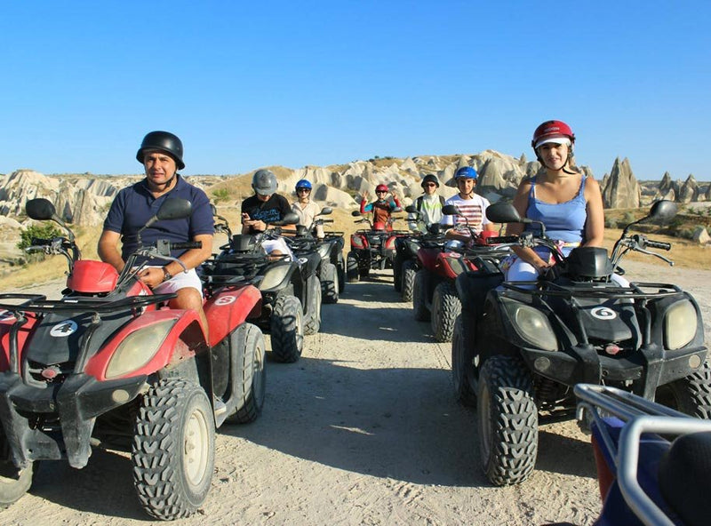

Guidet ATV-quad-tur i Kappadokien
Udsalg
Udsolgt
Normalpris
$28.38 USD
Normalpris
Stykpris
pr.
Udsalgspris
$28.38 USD


Jeep‑safari i Kappadokien
Udsalg
Udsolgt
Normalpris
$117.00 USD
Normalpris
Stykpris
pr.
Udsalgspris
$117.00 USD
Regionens næsten udenjordiske geografi opleves bedst fra oven, hvilket er grunden til, at varmluftballonflyvning her er blevet legendarisk. Ved solopgang kan over 100 balloner svæve over "fairy chimneys" på én gang — et syn, der for mange rejsende definerer Tyrkiet. Kappadokien omfatter de to hovedlufthavne: Nevşehir Kapadokya Airport (tættest) og Kayseri Erkilet Airport (større, med flere afgange).
Göreme fungerer som Kappadokiens turistknudepunkt og er hjemsted for det UNESCO-listede Göreme Frilandsmuseum med sine klippehuggede kirker og byzantinske fresker. Kappadokien-kortets detaljer afslører Ürgüp som det mere eksklusive valg, mens Avanos er berømt for sin keramiktradition, der går tilbage til hettitisk tid.
Underjordiske byer som Derinkuyu og Kaymaklı går helt op til otte etager ned i den bløde vulkanske klippe. Disse byer var forbundet af underjordiske tunneler, der strakte sig flere kilometer, så hele samfund kunne gemme sig for angribere. Ihlara-dalen, synlig på detaljerede kort, byder på fremragende vandring gennem en 16-kilometer lang kløft med flere klippekirker.
Istanbul: Hvor Øst møder Vest

Intet kort over Tyrkiet ville være komplet uden en omfattende dækning af Istanbuls skatte. Kappadokien-kortet over Tyrkiet kan vise geologiske vidundere, men Istanbul repræsenterer 2,500 års menneskelig bedrift. Fra Sultanahmet står Den Blå Moské (Sultan Ahmed-moskeen) overfor Hagia Sophia på en plads, der har været vidne til byzantinsk, osmannisk og republikansk historie.
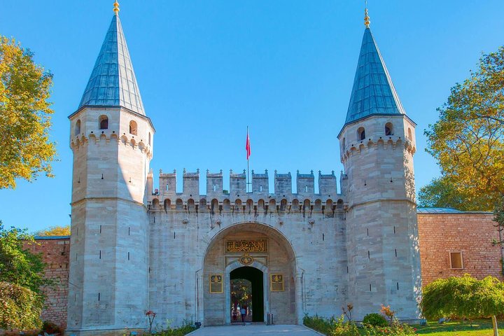
Topkapı-paladset, sultanernes residens i 400 år, ligger på en odde med udsigt over, hvor Bosporus møder Det Gyldne Horn. Basilica Cistern, bygget af den byzantinske kejser Justinian I, demonstrerer den ingeniørmæssige kunnen, der var nødvendig for at forsyne Konstantinopel med vand. Den Store Basar, med 61 overdækkede gader og over 4,000 butikker, har været i drift siden 1461.
En Bosporus-sejlads, som let kan findes på ethvert kort over Tyrkiets byer, byder på udsigt til kystpaladser (Dolmabahçe, Çırağan, Beylerbeyi), fæstninger (Rumeli Hisarı, Anadolu Hisarı) og broen mellem kontinenterne.
Antalya og Middelhavskysten

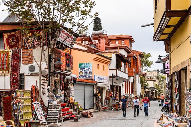
Middelhavsregionen på kortet har Antalya i centrum, Tyrkiets turist-hovedstad. kortet over Tyrkiet og Syrien viser Antalya-provinsen strække sig langs kysten og byde på alt fra all-inclusive-resorts til boutiquehoteller i restaurerede osmanniske huse. Den gamle bydel (Kaleiçi) har smalle brostensgader, osmannisk arkitektur og en romersk havn, der stadig er i brug.
Tæt på Antalya viser kortet over Tyrkiets byer Perge, en af Anatoliens rigeste romerske byer, og Aspendos, hjemsted for verdens bedst bevarede romerske teater, som stadig har sommerspil. Düden-vandfaldene styrter ud i Middelhavet og skaber en spektakulær naturoplevelse inden for byen.
Længere vest langs kortet over Tyrkiet og Syrien-kystregionen giver Fethiye adgang til vandrestien Lycian Way, Ölüdeniz' Blue Lagoon (ofte rangeret blandt verdens bedste strande) og den antikke spøgelsesby Kayaköy. kortet over Tyrkiets byer markerer Kaş og Kalkan som charmerende boutique-resorts, hvor bjerge dramatisk dypper ned i det turkisblå hav.
Ting at lave i Antalya
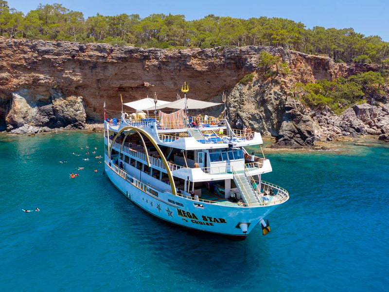
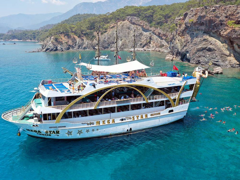
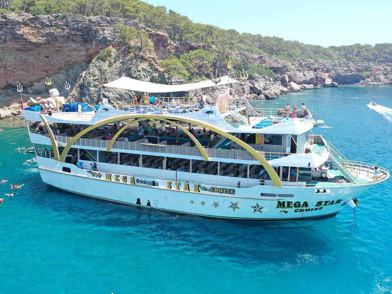
Antalya Mega Star yacht-tur med BBQ-frokost, skumfest & transport tur/retur
Udsalg
Udsolgt
Normalpris
$32.00 USD
Normalpris
Stykpris
pr.
Udsalgspris
$32.00 USD
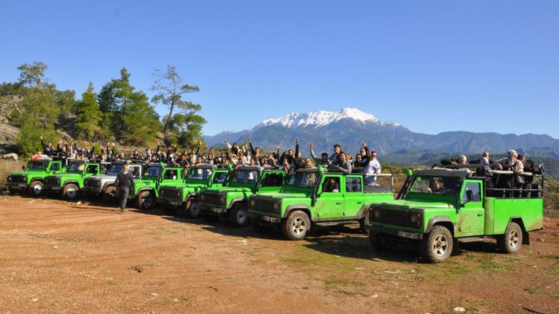


Antalya Jeep Safari-tur med off-road, BBQ-frokost og transport
Udsalg
Udsolgt
Normalpris
$38.00 USD
Normalpris
Stykpris
pr.
Udsalgspris
$38.00 USD
Antalya bytur med vandfald, bådtur, BBQ-frokost & roundtrip transfer
Udsalg
Udsolgt
Normalpris
$45.00 USD
Normalpris
Stykpris
pr.
Udsalgspris
$45.00 USD


River Rafting-tur i Koprulu Canyon med frokost & tur/retur transport fra Antalya
Udsalg
Udsolgt
Normalpris
$20.00 USD
Normalpris
Stykpris
pr.
Udsalgspris
$20.00 USD


Billet til Land of Legends-forlystelsespark med transfer
Udsalg
Udsolgt
Normalpris
$102.00 USD
Normalpris
Stykpris
pr.
$87.00 USD
Udsalgspris
$102.00 USD
Pamukkale: Bomuldsslottet

Pamukkales placering på kortet viser, at det ligger inde i landet fra Ægæerkysten, cirka 240 kilometer fra İzmir. "Bomuldsslottet" har sit navn fra de snehvide travertinterrasser, der er dannet gennem årtusinder af kalkrige termiske kilder. Pamukkale ligger i det sydvestlige Tyrkiet, nemt tilgængeligt fra både kystresorts og Kappadokien.
Den antikke by Hierapolis kroner plateauet over travertinerne. Grundlagt som en termal kurby i 190 BCE, byder Hierapolis på et velbevaret teater, en nekropolis (antik kirkegård) og det antikke bassin, hvor du kan svømme blandt nedsænkede romerske søjler. kortet over Tyrkiet angiver Denizli som den nærmeste større by, med sin egen lufthavn og togstation.
De termiske kilder holder en konstant temperatur på 36°C (97°F) året rundt, hvilket skaber de hvide calciumaflejringer, når vandet løber ned ad bjergsiden. Det er påkrævet at gå barfodet på travertinerne for at beskytte dette skrøbelige UNESCO-verdensarvssted, og der er indført særlige besøgsperioder for at bevare formationerne.
Ephesus: Et antikt vidunder

Kortet over Ephesus i Tyrkiet placerer dette bemærkelsesværdige arkæologiske sted nær Selçuk, omkring 80 kilometer syd for İzmir. På sit højdepunkt var Ephesus en af de største byer i det romerske imperium, med 250,000 indbyggere.
Celsus-biblioteket, Ephesus' mest ikoniske bygning, rummede engang 12,000 ruller og fungerede som et monumentalgravsted for den romerske senator Tiberius Julius Celsus Polemaeanus. Det Store Teater kunne rumme 25,000 tilskuere til gladiatorkampe og teaterforestillinger. Artemistemplet, hvor kun en enkelt søjle står tilbage, var et af de syv vidundere i den antikke verden og fire gange så stort som Parthenon i Athen.
Terrassehusene, nogle gange kaldet "de riges huse", har bemærkelsesværdige fresker og mosaikker, der viser velhavende romeres livsstil. Kortet viser nærliggende attraktioner, herunder Jomfru Marias Hus (hvor traditionen siger, at Maria tilbragte sine sidste år), Sankt Johannes-basilikaen (bygget over apostlens grav) og İsa Bey-moskeen, som fremviser tidlig osmannisk arkitektur.
Flere steder du ikke må misse
Kortet over Tyrkiet og Syriens grænseregion omfatter Hatay-provinsen, hjemsted for Antakya (det antikke Antiochia), hvor du finder det imponerende Antakya Arkæologiske Museum med verdens største mosaiksamling. Kortet markerer Gaziantep som det kulinariske centrum, berømt for baklava og kobberbasarer.
Søen Van, Tyrkiets største sø, dukker op i øst og byder på de unikke Van-katte, armenske kulturarvssteder som Akdamar-øens kirke og månelignende saltsølandskaber. Sortehavsregionen, synlig mod nord, har Sumela-klosteret, der klamrer sig til en klippevæg, samt de frodige teplantager omkring Rize og Trabzon.
Regionale rejsetips: Mindre kendte områder på kortet
Troy: Opdag den legendariske by
Kortet over Troy i Tyrkiet præciserer dette legendariske sted nær byen Tevfikiye i Çanakkale-provinsen, omkring 30 kilometer syd for byen Çanakkale. Troy kontrollerede den sydlige indgang til Dardanellerne, hvilket gjorde den strategisk vigtig for kontrol med søhandelen mellem Ægæerhavet og Sortehavet, præcis som Homer beskrev i Iliaden.
Udgravningsstedet afslører ni lag af civilisation, der spænder over 4,000 år, fra 3000 BCE til den byzantinske periode. Troy-kortets placering forklarer, hvorfor denne by var så værdifuld: den, der kontrollerede Troy, kontrollerede adgangen til de rige handelsruter til Sortehavet.
Troy ligger i krydset mellem europæiske og asiatiske handelsruter, hvilket gav byen rigdom nok til at opføre enorme forsvarsmure (nogle stadig stående op til 5 meters højde). Stedets museum udstiller genstande fra hver periode, herunder guldsmykker, våben og keramik, der viser Trojas forbindelser med mykensk Grækenland, Anatolien og videre.
Mardin og det sydøstlige Tyrkiet
Kortet over Tyrkiet og Syriens grænseregion afslører Mardin, en betagende by på en højderyg med honningfarvet stenkarkitektur, der kaskader ned ad bjergsiden med udsigt over Mesopotamiens sletter. Kortets østlige udstrækning mod Tyrkiet og Iran viser denne region som civilisationens vugge, hvor landbrug, skrift og byliv først udviklede sig langs Tigris og Eufrat.
Mardins gamle bydel byder på Artuqide-arkitektur med Zinciriye Medrese (teologisk skole) og Kasımiye Medrese, der fremviser indviklet stenhuggeri unikt for denne region. kortet over Tyrkiet og de omkringliggende lande afslører Mardins nærhed til det gamle Mesopotamien, kun 20 kilometer fra den syriske grænse.
Ikke langt derfra ligger Şanlıurfa (bibelske Edessa), hjemsted for Göbekli Tepe, dateret til 9600 BCE — verdens ældste kendte tempelkompleks, der forudgår Stonehenge med 6,000 år og pyramiderne med 7,000 år. Denne opdagelse omskrev menneskets historie, da den beviste, at komplekse samfund og monumental arkitektur eksisterede før landbruget.
Diyarbakır, synlig på kortet over Tyrkiet og de omkringliggende lande, har de længste og bedst bevarede bymure efter Den Kinesiske Mur (5.5 kilometers sorte basaltvolde). Byen ligger ved bredden af Tigris-floden, som kortet over Tyrkiet og Syrien viser, flyder mod syd gennem Irak til Den Persiske Bugt.
Sortehavsregionen
Nordkysten afslører Sortehavsregionen, Tyrkiets grønneste og mindst turistede område. I modsætning til de tørre landskaber, man ofte forbinder med Tyrkiet, modtager denne region rigelig nedbør, som understøtter frodige skove, teplantager og hasselnøddeplantager. Trabzon, historisk kendt som Trebizond, var hovedstad i en byzantinsk efterfølgerstat, som overlevede Konstantinopels fald i 1453 med otte år.
Kortet over Tyrkiet og Syrien viser Trabzon 1,100 kilometers nordøst for den syriske grænse — omtrent så langt du kan komme inden for Tyrkiets grænser. Det nærliggende Sumela-kloster, dramatisk placeret på en klippevæg 1,200 meters højde, er et af Tyrkiets mest spektakulære seværdigheder. Grundlagt i 386 CE forblev det et vigtigt græsk-ortodokst pilgrimssted indtil 1923.
Kortet over Tyrkiet og de omkringliggende lande viser, at den østlige Sortehavsregion (Kaçkar-bjergene) byder på Tyrkiets bedste trekking og rafting i hvidt vand. Regionens yayla-kultur (højlandsgræsgange) indebærer, at landsbyboere flytter deres husdyr til bjergenge hver sommer — en livsstil uændret i århundreder. Rize og Hemşin-dalene, synlige på detaljerede kort over Tyrkiet og Iran ressourcer, fremviser denne unikke kultur.
Ayder-plateauet, markeret på den østlige kort over Tyrkiet og de omkringliggende lande, kombinerer varme kilder med alpin natur i 1,350 meters højde. Regionens unikke arkitektur byder på træhuse med stejle tage designet til kraftig snefald. I modsætning til de turistfyldte sydkyster tilbyder Sortehavet autentiske kulturoplevelser med minimal turistinfrastruktur.
Østlige grænse: Hvor imperier mødtes
Den fjernøstlige kort over grænseregionen mellem Tyrkiet og Iran repræsenterer Tyrkiets vilde grænseland, hvor anatoliske, persiske, armenske og kurdiske kulturer mødes. Dette område modtager færre turister end noget andet sted i Tyrkiet, men byder til gengæld på spektakulær natur og dyb historisk betydning.
Kars, nær den armenske grænse på kortet over Tyrkiet og Iran, rummer russisk kejserlig arkitektur fra besættelsen 1878-1918. De nærliggende ruiner af Ani, den middelalderlige armenske hovedstad, står som en spøgelsesagtig by med storslåede kirker og bymure. kortet over Tyrkiet og de omkringliggende lande viser Ani bogstaveligt talt på den tyrkisk-armenske grænse, et symbol på regionens komplekse historie.
İshak Pasha-paladset nær Doğubayazıt, synligt på kortet over Tyrkiet og Iran, forener osmanniske, persiske, armenske og georgiske arkitekturelementer i et storslået højdelandskompleks med udsigt over Mount Ararat. kortet over Tyrkiet og Syrien viser den relative afstand og placerer Mount Ararat (5,137 meter) i Tyrkiets fjerneste nordøstlige hjørne, nær hvor de tyrkiske, armenske og iranske grænser mødes.
Søen Van, verdens største alkaliske sø, fremgår tydeligt på det østlige kort over Tyrkiet og de omkringliggende lande. Søens høje saltindhold forhindrer det meste liv bortset fra perlemultefisk, mens det omkringliggende område byder på unikke Van-katte (tofarvede hvide katte, der elsker at svømme), kurdisk kultur og den 10. århundredes armenske Hellig Kors-kirke på Akdamar-øen.
Tips til at navigere i Tyrkiet med et kort
Brug af Google Maps i Tyrkiet
Google Maps i Tyrkiet er bemærkelsesværdigt omfattende og pålideligt til at navigere i tyrkiske byer og motorveje. Platformen dækker også små landsbyer, hvilket gør den uvurderlig til roadtrips. Når du bruger offline-kort i Tyrkiet, kan du downloade hele regioner i Google Maps til brug uden internetforbindelse — vigtigt i landområder, hvor mobildækningen kan være ujævn.
Google Maps' grænseflade i Tyrkiet understøtter både tyrkisk og engelsk og oversætter automatisk stednavne og adresser. Det er dog en fordel at kende et par navigationstips: Tyrkiske adresser skrives med bydelen først (f.eks. "Sultanahmet, Fatih, Istanbul"), og gader kaldes "Sokak" (forkortet Sk.), mens avenuer hedder "Caddesi" (forkortet Cd.).
Offentlig transport i Istanbul er fuldt integreret i kortplatformen. Appen giver realtidsopdateringer for metro, sporvogn, færge og bus og beregner ruter, der kombinerer flere transportformer. For eksempel kan en rejse fra den asiatiske side til Sultanahmet kombinere færge og sporvogn, og offline-downloads sikrer, at du kan navigere, selv hvis du mister internetforbindelsen midt på rejsen.
Google Maps i Tyrkiet beregner køretider præcist og tager højde for Tyrkiets bjergrige terræn, hvor afstande kan være vildledende. Den 450-kilometer lange køretur fra Istanbul til Ankara tager 4-5 timer på fremragende motorveje, men samme distance i det østlige Anatolien kan tage 7-8 timer på snoede bjergveje. Kortets ruteplanlægningsfunktion for tyrkiske byer hjælper med at sætte realistiske rejseforventninger.
Offline-navigation: det essentielle
Det er vigtigt at downloade offline-kort til Tyrkiet før din rejse, især hvis du vil udforske områder uden for de store byer. Google Maps gør det muligt at downloade hele provinser, så navigationen fungerer selv i fjerntliggende områder som Kaçkar-bjergene eller Nemrut Dağı, hvor mobildækningen kan være ustabil. Offlinefunktionen inkluderer gemte steder, markerede lokationer og tidligere søgte destinationer.
Alternative apps som Maps.me tilbyder fremragende offline-navigation med detaljerede vandrestier, bjergtoppe og interessepunkter, som ikke altid vises på standardkortplatforme. Appen bruger OpenStreetMap-data, som ofte er mere detaljerede for landdistrikter og arkæologiske steder. Kombineret med digitale kort har du en backup, hvis en app svigter.
Til bilkørsel bør du overveje at downloade offlineområder, der går ud over din planlagte rute. Tyrkiske roadtrips frister ofte til spontane afstikkere til det slot på bakken eller det landsbymarked, du fik øje på fra motorvejen. Kortets offlinekapacitet for tyrkiske byer betyder, at du kan navigere disse spontane eventyr uden dyre roamingdata.
Navigation med offentlig transport
De største tyrkiske byer har avancerede offentlige transportsystemer, der fremgår af detaljerede bykort. Istanbuls integrerede system omfatter metro, sporvogn, funikulær, færge, bus og metrobus (hurtigt busnet). Istanbulkart — det genopladelige kort — kan bruges på alle transportmidler, og digitale kort viser, hvor kortet accepteres, samt beregner omligningstider.
Ankaras metrosystem forbinder lufthavnen, togstationen og de vigtigste kvarterer, og alt er synligt i offline-downloads. Brugerfladen viser ankomsttider i realtid og eventuelle driftsforstyrrelser. Izmirs metro- og færgesystemer er på samme måde integreret i digitale kortplatforme.
Til intercity-rejser kan afstande mellem byer dækkes af omfattende bussystemer, indenrigsflyvninger eller højhastighedstog. YHT (Yüksek Hızlı Tren) forbinder Istanbul–Ankara–Konya og reducerer rejsetiden markant. Google Maps i Tyrkiet inkluderer togkøreplaner, men selve booking foregår stadig via TCDD (Turkish State Railways) websted eller app.
GPS-koordinater og What3Words
Fjernliggende arkæologiske steder, bjergtoppe og gæstehuse på landet mangler ofte ordentlige vejadresser. GPS-koordinater eller What3Words-adresser bliver uvurderlige. Mange tyrkiske turistwebsites angiver nu præcise koordinater, som du kan indtaste direkte i Google Maps i Tyrkiet for trin-for-trin-navigation til det afsidesliggende kloster eller en bjerg‑yayla.
Offline-GPS-funktionen virker uden mobildata ved at bruge din telefons indbyggede GPS-modtager. Det betyder, at selv midt ude i ingenting vil din blå prik vise præcis, hvor du er i både byområder og på landet. Download kort, før du mister signal.
Praktiske navigationsråd
Tyrkiske vejskilte bruger både tyrkiske og internationale symboler, og større destinationer er markeret med det latinske alfabet. Mindre byer kan dog kun vise tyrkiske navne, så sæt dig ind i den tyrkiske stavemåde på din destination på digitale kort, inden du tager afsted.
Rastepladser dukker op hver 40-50 kilometer på hovedmotorvejene og er markeret i ruteplanlægningsværktøjer. Her finder du rene toiletter, madmuligheder og brændstof. Sørg altid for at tanke op ved disse i stedet for at vente til byerne, da tankstationer på landet kan være sparsomme.
Det kan være udfordrende at køre i større byer. Realtids trafikinformation hjælper med at undgå kødannelser, men husk, at myldretiden (kl. 8-10 og 17-20) i Istanbul kan forvandle en 30-minutters tur til et 2-timers mareridt. Offline-kort viser ikke trafik i realtid, så planlæg i forvejen eller brug offentlig transport i myldretiden.
For færgerejser, især omkring Istanbul og Dardanellerne, viser digitale kort færgeterminaler og sejlplaner. Kontroller dog tider lokalt, da afgange kan ændre sig i løbet af sæsonen. I kystområder er det vigtigt at vide, hvornår færger sejler, og hvornår broer eller tunneller er et alternativ.
Ofte stillede spørgsmål (FAQ)
Hvor ligger Tyrkiet på verdenskortet?
Når du undersøger, hvor Tyrkiet ligger på verdenskortet, finder du det i krydsfeltet mellem Europa og Asien, mellem 36-42° nordlig bredde og 26-45° østlig længde. Landet omfatter Anatoliens halvø samt en lille del af det sydøstlige Europa.
Tyrkiet grænser op til otte lande og er omgivet af fire have: Sortehavet (nord), Middelhavet (syd), Det Ægæiske Hav (vest) og Marmarahavet (nordvest). Istanbul spænder unikt over to kontinenter via Bosporusstrædet, hvilket gør Tyrkiet til en bro mellem Øst og Vest.
Hvad gør Tyrkiets flag særligt på kort?
Tyrkiets flag viser en hvid halvmåne og stjerne på rød baggrund. Designet går tilbage til 1844 og blev officielt vedtaget i 1936. Flagets symbolik afspejler dele af Tyrkiets islamiske arv, selvom disse symboler er ældre end islam i Anatolien.
Hvordan navigerer jeg i Tyrkiet under min rejse?
Tyrkiet dækker 783,562 kvadratkilometer, så afstande kan være betydelige. De større byer tilbyder fremragende offentlig transport. Istanbuls metro-, sporvogns-, færge- og bussystemer er særligt effektive.
At leje en bil giver fleksibilitet til at udforske områder som Cappadocia eller Middelhavskysten. Tyrkiske motorveje er generelt fremragende. GPS-apps fungerer godt, men download offline-kort til landdistrikterne.
Hvilke byer er mest populære at besøge i Tyrkiet?
Kortet over Tyrkiet fremhæver Istanbul som den øverste destination, der spænder over to kontinenter. Cappadocia-regionen (Göreme, Ürgüp, Avanos) er berømt for varmluftballonture og hulehoteller.
Kystfavoritterne omfatter Antalya (Turkiets riviera), Bodrum og Fethiye. Kulturelle byer, der er værd at besøge, er Ankara, Izmir, Konya, Trabzon og Gaziantep.
Hvilke regioner er bedst til historisk udforskning?
Vesttyrkiets ægæiske kyst byder på antikke græske og romerske ruiner: Ephesus, Pergamon, Aphrodisias og Troy.
Centrale Anatolien viser hittitisk arv i Hattusa og seljukisk historie i Konya. Sydøstlige Tyrkiet rummer Göbekli Tepe (ca. 9600 f.Kr.), verdens ældste tempel.
Istanbul repræsenterer tre imperier med Hagia Sophia, Topkapı-paladset og Den Blå Moské. Det østlige Tyrkiet byder på armensk kulturarv i Ani og Van.
Hvordan planlægger jeg en roadtrip gennem Tyrkiet?
Planlægning kræver, at du forstår afstande på kortet. Fra Istanbul til Mount Ararat er der 1,850 kilometer.
-
Vestlig rute (7-10 dage): Istanbul, Troy, Pergamon, Ephesus, Pamukkale
-
Sydkysten (10-14 dage): Antalya til Bodrum langs Middelhavet
-
Centrale Anatolien (5-7 dage): Ankara, Cappadocia, Konya
-
Østligt eventyr (14-21 dage): Trabzon til Gaziantep via Mount Ararat og Göbekli Tepe
Som vi har gennemgået i denne guide, viser kortet over Tyrkiets byer et land af ekstraordinær mangfoldighed, hvor oldtidens historie møder moderne liv. At forstå Tyrkiet på kortet giver dig mulighed for at skræddersy dit perfekte eventyr, uanset om du drages af Istanbuls kejserlige pragt, Cappadocias eventyrlige klippeformationer, Det Ægæiske Havs antikke ruiner eller det østlige Anatoliens barske skønhed.
Kortet over Tyrkiet viser mere end geografiske grænser. Det er en køreplan gennem 12,000 års menneskelige bedrifter og en guide til naturens vidundere fra snedækkede bjerge til uspolerede middelhavstrande. Tyrkiets unikke position som bindeled mellem Europa og Asien gør det til et land, hvor du kan stå på ski om morgenen og svømme om eftermiddagen.
Klar til at begynde dit tyrkiske eventyr?
Brug det detaljerede kort over Tyrkiet med byer, vi har leveret, til at planlægge din perfekte rute. Uanset om det er en kystrejse, historisk udforskning eller et eventyr uden for de slåede veje, venter din rejse.
Vi vil gerne høre fra dig!
Hvilken region fascinerer dig mest? Cappadocias varmluftballoner? Det antikke Ephesus? Gazianteps kulinariske lækkerier? Del dine yndlingsfund eller drømmedestinationer i kommentarfeltet nedenfor.
Har du spørgsmål om at navigere i Tyrkiet? Spørg endelig. Vi er her for at hjælpe dig med at gøre dine 'Tyrkiet på kortet'-drømme til virkelighed!
Begynd at planlægge i dag. Enhver stor rejse begynder med at forstå kortet. Tyrkiet venter.
Map of Turkey: Must-Visit Destinations and Best Travel Locations

